The Weight of the Tajo
Ronda’s Puente Nuevo is more than an icon; it is a brutal negotiation between limestone geology and the necessity of vertical passage.
By Mistral & Marea · Updated 14 OCT 2026
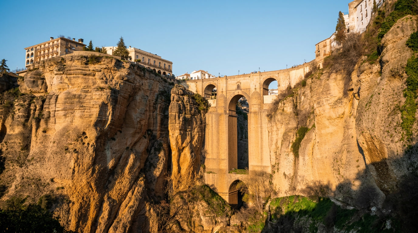
The Weight of the Tajo
Geology as Infrastructure
To stand upon the Puente Nuevo is to occupy a precarious truce between the city and the Guadalevín river. Completed in 1793 after over four decades of construction, the bridge serves as the primary suture across the Tajo gorge. The architectural weight of the structure—designed by José Martín de Aldehuela—is not merely aesthetic. It is a literal anchoring into the massive limestone escarpment that defines Ronda’s topography.
The masonry, composed of stone quarried from the gorge itself, demands a reading of raw material capacity. The central arch, reaching nearly 100 meters above the canyon floor, functions as an extension of the cliff face. When one observes the stone, the distinction between the natural strata and the human-wrought blocks blurs. This was a deliberate structural strategy to ensure the bridge could withstand the seismic shifts and wind loads endemic to the Serranía de Ronda.
The municipal planning records for the town highlight the ongoing tension between preserving this structural integrity and accommodating modern pedestrian flow. The bridge is not a static object; it is an active participant in the city's maintenance regime. Constant monitoring of the foundation’s contact points with the gorge walls is required, as the limestone remains susceptible to the slow, relentless pressure of water erosion and thermal expansion. Unlike the coastal architectures of the Mediterranean, which often prioritize light and permeability, Ronda’s built environment is defined by this defiance of the void. The bridge does not span the gap so much as it consumes it, asserting a heavy, singular presence against the erosion of the landscape.
Sources and notes: Information regarding the construction dates and structural history is sourced from the Ayuntamiento de Ronda’s urban planning archives and historical records on the Puente Nuevo. Geological context is informed by the Instituto Geológico y Minero de España’s documentation of the Serranía de Ronda landscape.
“The daily record is where a place reveals its actual rhythm.”
Mistral & Marea · field note